
You do not have to climb Mount Sanitas or scramble toward the Flatirons to get a memorable Boulder hiking experience. Some of the best easy hikes near Boulder are short meadow walks, creek paths, lake loops, and open-space trails where the scenery arrives long before the elevation gain does.
That distinction matters for first-time visitors and people relocating to Boulder. A trail can look short on a map but still climb steeply, while a longer creek path may be nearly level and easy to shorten whenever you want. The most useful question is therefore not simply, “How many miles is it?” but “How steep is it, what is the surface like, and can I turn around easily?”
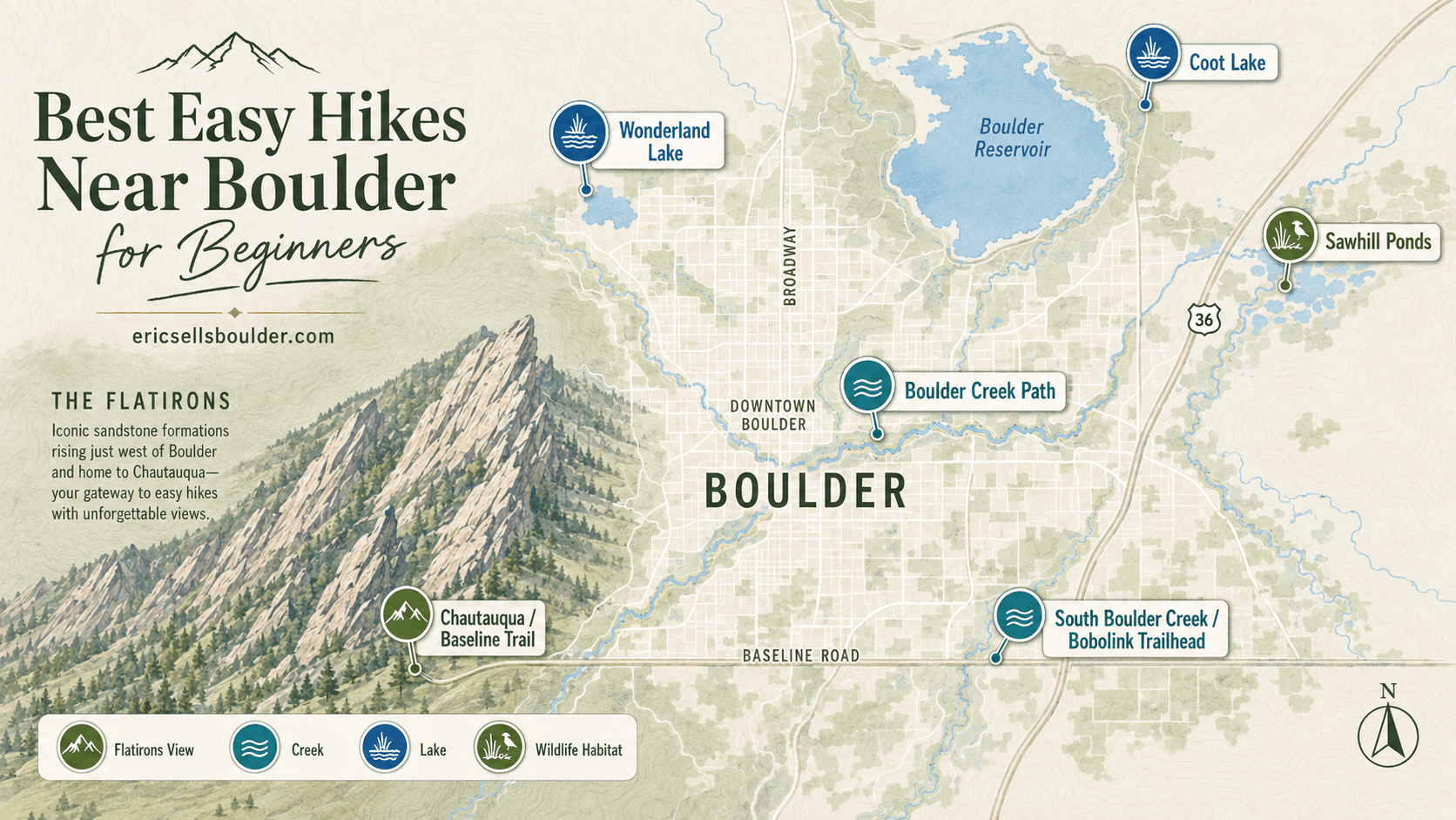
Below are some of Boulder’s strongest beginner options, including Chautauqua and Flatirons viewpoints, Boulder Creek, Wonderland Lake, South Boulder Creek, and several low-effort wildlife walks.
The Best Easy Boulder Hikes at a Glance
For the easiest combination of scenery and manageable terrain, start with Boulder Creek Path, Wonderland Lake, Coot Lake, Sawhill Ponds, or the Baseline Trail at Chautauqua. Chautauqua Trail itself is iconic, but it climbs more than its short mileage may suggest.
| Trail or area | Published distance | Published elevation gain | Why beginners may like it |
|---|---|---|---|
| Baseline Trail at Chautauqua | 0.6 mile | 181 ft. | Short, officially rated easy, with open Flatirons views |
| Boulder Creek Path | 5.5 miles total | Varies | Mostly flat, paved, and easy to shorten |
| Wonderland Lake | 1.1-mile trail | 93 ft. | Lake, foothills scenery, and modest climbing |
| South Boulder Creek | 3.4 miles total | 248 ft. | Creekside route that works well as a short out-and-back |
| Coot Lake | About 1.2 miles around lake | Minimal | Simple lake circuit with mountain views |
| Sawhill Ponds | 1.6 miles | 68 ft. | Wetlands, wildlife viewing, benches, and very little climbing |
| Chautauqua Trail | 0.7-mile listed trail segment | 459 ft. | Classic Flatirons scenery, but noticeably steeper |
Distances and elevation figures above come from current City of Boulder trail and recreation pages accessed August 20, 2026. Routes can be rerouted or temporarily closed, so check the current trail map before leaving.
For a first outing, do not feel obligated to complete a published route. Boulder Creek Path and South Boulder Creek are particularly useful because you can walk for 15, 30, or 60 minutes and reverse direction without turning the outing into a major hike.
Chautauqua: The Easiest Way to Get Classic Flatirons Views
For a beginner who primarily wants a Flatirons view, you do not need to hike to the Flatirons themselves. Chautauqua Meadow and the Baseline Trail provide the signature Boulder backdrop with substantially less commitment than the First and Second Flatiron Trail.
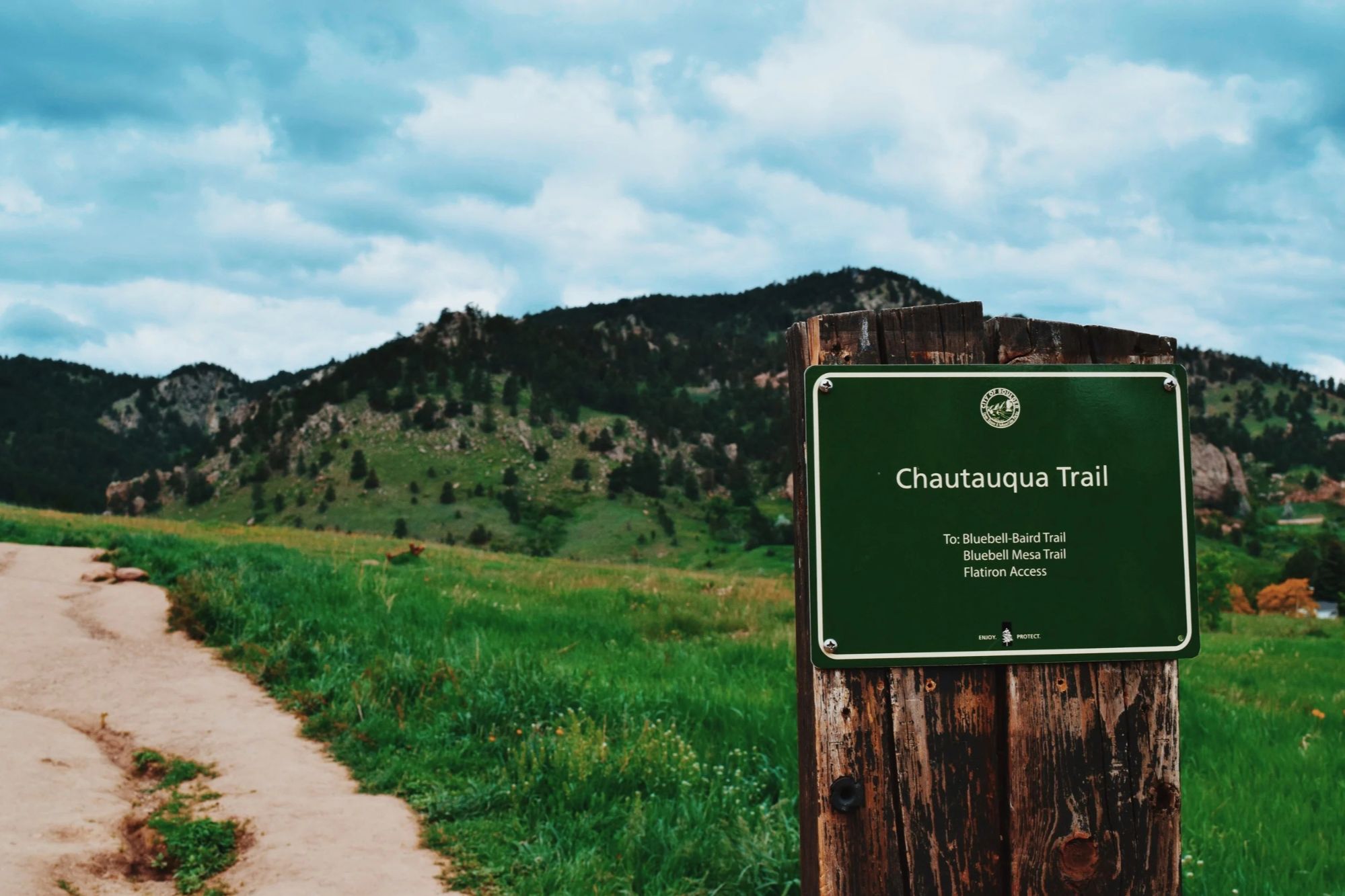
The City of Boulder rates Baseline Trail as easy. Its published length is 0.6 mile with 181 feet of elevation gain, and it runs along the lower edge of Chautauqua with views across open fields toward the Flatirons.
Chautauqua Trail is the next step up. OSMP lists it as easy/medium, with a published 0.7-mile trail length and 459 feet of elevation gain. The trail heads directly uphill through the meadow, so someone arriving from a flatter part of the country may find it more strenuous than the mileage suggests.
That distinction is worth emphasizing because some of Boulder's most famous trails are not beginner walks. The City classifies the First/Second Flatiron Trail as moderate to difficult, while the nearby Flatirons Loop is rated medium and includes 315 feet of gain in 0.7 mile.
A good beginner plan is simple: walk the lower meadow or Baseline Trail, continue uphill only while the grade remains comfortable, and turn around when you have had enough. You still get one of the defining Boulder views without making a summit the goal.
For an even shorter scenic stop, Artist Point on Flagstaff Mountain is a 0.1-mile easy trail with just 42 feet of published elevation gain. It provides a foothills and Rocky Mountain viewpoint rather than the classic head-on Flatirons composition. Access to Flagstaff Summit Road is seasonal; the city currently lists it as open May 1 through October 30.
Boulder Creek and South Boulder Creek for Easy Creekside Walking
If elevation gain is your main concern, Boulder’s creek corridors are among the easiest places to start. They also show a different side of the city than the foothill trailheads.
The Boulder Creek Path is the most flexible choice. The city describes it as a 5.5-mile multi-use path stretching from Boulder Canyon on the west to the Stazio Ballfields area east of 55th Street. It passes the Main Library, Civic Area, and Boulder Dushanbe Teahouse and is described by the city as scenic and mostly flat.
Beginners do not need to walk all 5.5 miles. Starting in the Civic Area and walking west or east for 20 to 30 minutes creates an easy out-and-back with virtually no route-finding. Because the corridor serves walkers, runners, cyclists, and other users, stay to the right and remain aware of faster traffic.
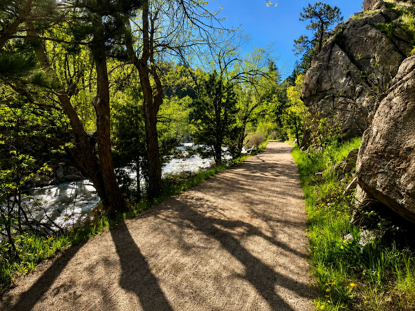
For a more natural-surface setting, try South Boulder Creek from Bobolink Trailhead at 5880 Baseline Road. The full South Boulder Creek Trail is 3.4 miles with 248 feet of gain and an easy/medium rating, but a beginner can simply walk the shaded creekside portion and return. The Bobolink trailhead is also identified by OSMP as mobility-friendly and is served by Route 225 near Baseline and Cherryvale.
Rules change along South Boulder Creek. For example, dogs are prohibited on portions south of South Boulder Road, and bicycle access varies by trail segment. Check posted signs rather than assuming the same rules apply to the entire corridor.
Wonderland Lake, Coot Lake, and Sawhill Ponds for Low-Effort Scenery
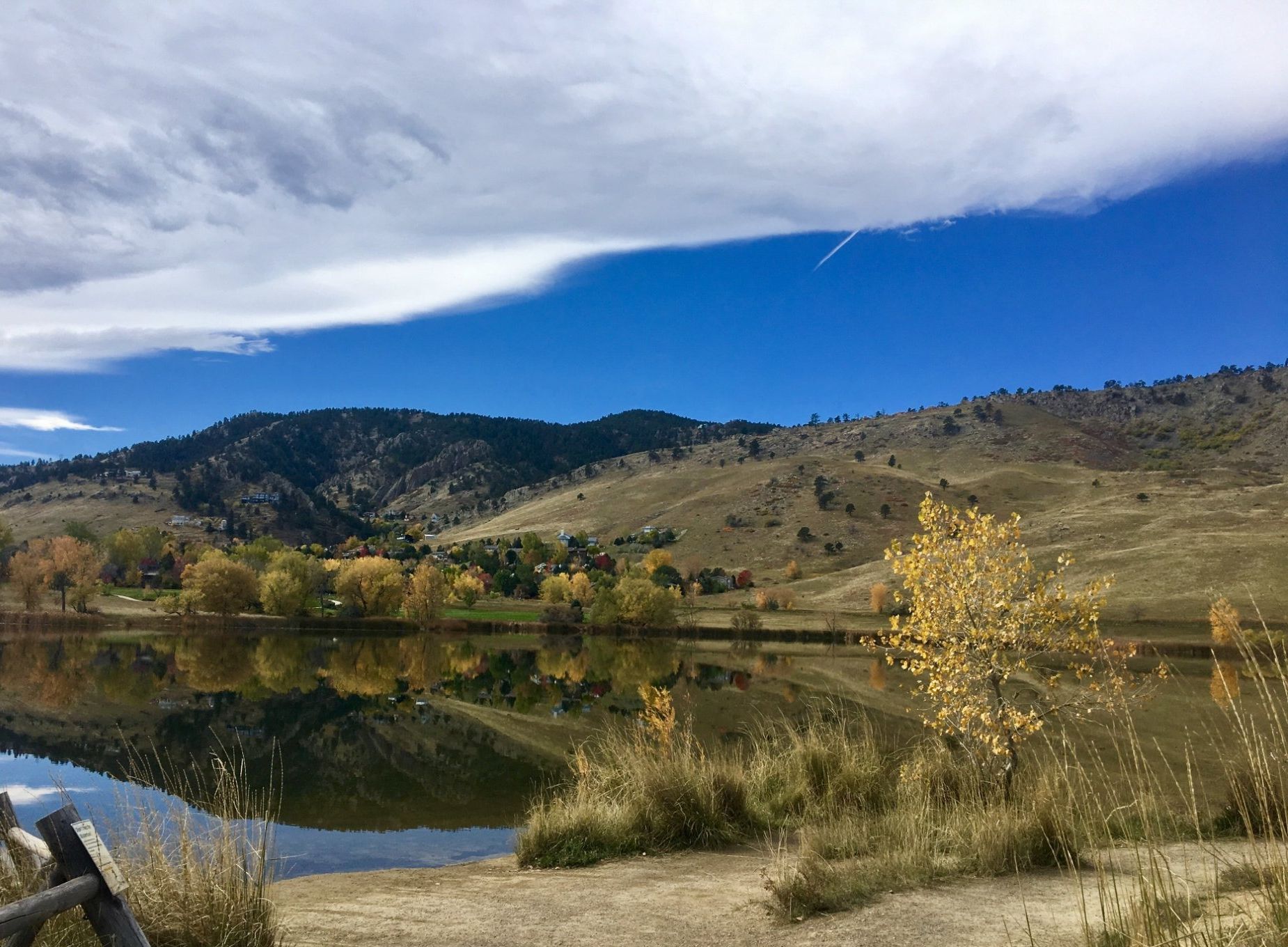
Lake and wetland trails are some of Boulder’s most reliable choices when you want scenery with minimal climbing. They are especially useful when foothill grades do not sound appealing.
Wonderland Lake
The City of Boulder lists the Wonderland Lake Trail at 1.1 miles with only 93 feet of elevation gain and an easy/medium rating. The route passes wetlands, prairie, streams, and the lake beneath the north Boulder foothills. It is also identified as mobility-friendly, although individual surface conditions and accessibility needs should always be checked before visiting.
The trailhead is at 4201 North Broadway. It has no trailhead fee, and the SKIP stops on Broadway adjacent to the trailhead. Dogs must be on a hand-held leash in the Wonderland Lake area.
Coot Lake
Coot Lake, northeast of central Boulder near the Boulder Reservoir, is approximately 1.2 miles around. The route combines lake, wetlands, and mountain views and includes restroom access. The city notes that sections of the shoreline are protected wetlands, and dog access varies by side of the lake.
Sawhill Ponds
For wildlife rather than dramatic foothill terrain, Sawhill Ponds is hard to overlook. The City lists its trail at 1.6 miles, 68 feet of elevation gain, and easy/medium difficulty. The preserve contains 18 ponds, connecting paths, benches, fishing opportunities, and views toward both the mountains and plains.
Sawhill is east of Boulder city limits on 75th Street. The trailhead has restrooms and picnic facilities, although there is no drinking water.
These three areas also demonstrate why “Boulder hiking” should not be treated as synonymous with steep foothill trails. North and east Boulder provide very different walking experiences from Chautauqua, even though all are within the broader Boulder trail network.
How to Make an “Easy” Boulder Hike Actually Feel Easy
Choose by grade, surface, weather, and turnaround options rather than mileage alone. That approach prevents one of the most common beginner mistakes: assuming a short Boulder trail must be easy.
OSMP’s difficulty system considers grade, obstacles, stairs, distance, and proximity to access points. Its general definition of an easy trail includes average grades generally below 6 percent, short distances, low maximum grades, few obstacles, and few or no stairs. Easy/medium means the route contains a mix of easier and more moderate sections.
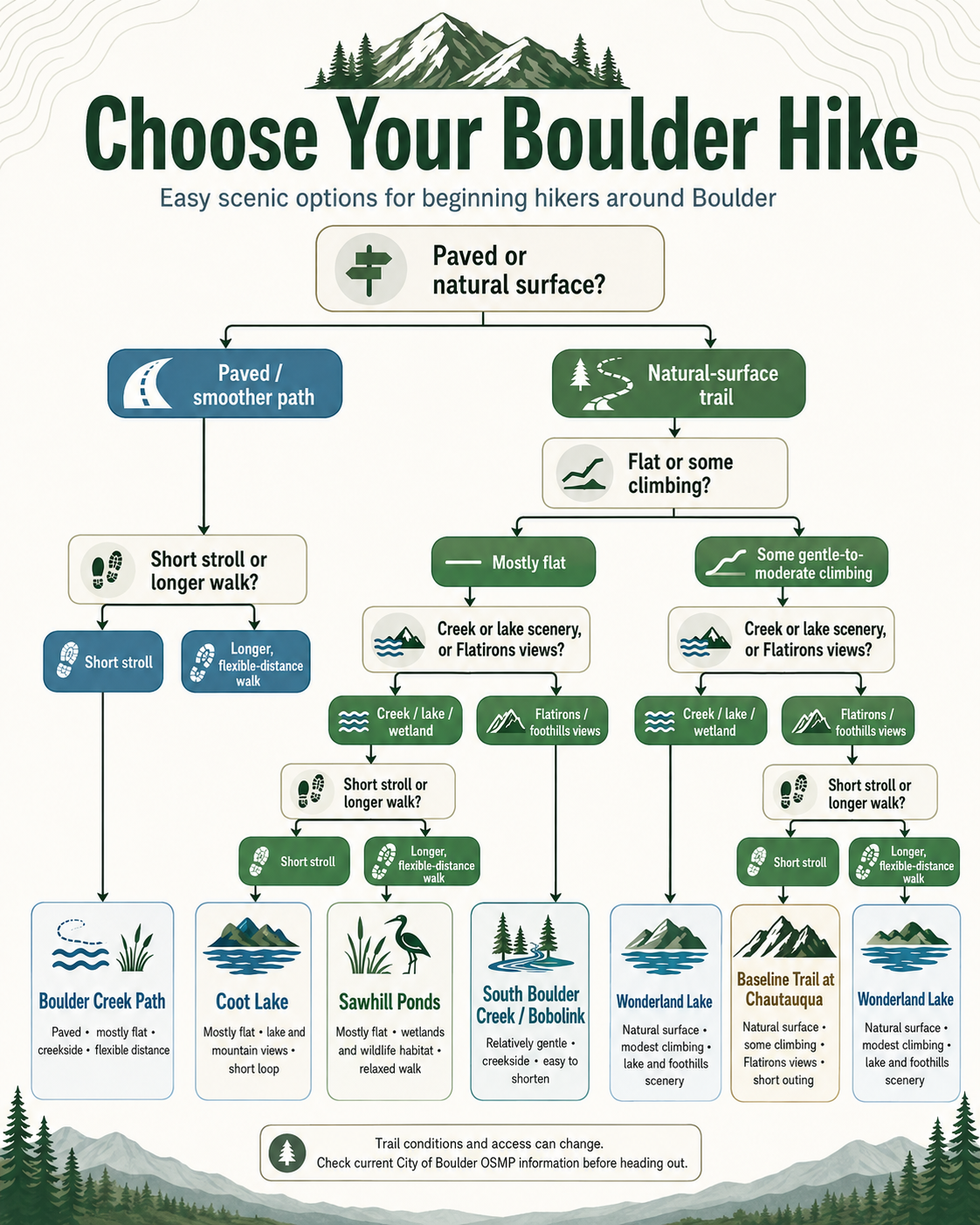
For a comfortable first outing:
- Favor Boulder Creek Path, Wonderland Lake, Coot Lake, Sawhill Ponds, or Baseline Trail before trying steeper foothill routes.
- Treat Chautauqua Trail as a short climb rather than a flat stroll.
- Choose an out-and-back route when you want complete control over distance.
- Check the trail surface if mobility, stroller wheels, balance, or footwear are considerations. “Mobility-friendly” does not mean every trail works equally well for every person.
- Bring water and sun protection even for short hikes. Open meadows such as Chautauqua can have little shade.
- In winter or after freeze-thaw cycles, expect snow, ice, or mud to change the difficulty substantially.
- Check OSMP’s closure map on the day of the hike. Wildlife protection, maintenance, mud, wildfire, and emergency conditions can all affect access.
Boulder’s accessible-trail resources are also useful even if you do not need an ADA-oriented route. The city publishes comparative information on surfaces, shade, grades, restrooms, and known obstacles for trails including Wonderland Lake, Bobolink, Coot Lake, Sawhill Ponds, and Ute.
Parking, Trail Access, and What Buyers Should Notice About Living Near Open Space
For someone considering a move to Boulder, trail proximity is useful only when you understand the actual access, parking, transportation, and property conditions at a specific address. A house that looks close to open space on a listing map may not have a convenient public entrance, while another property farther away may connect easily by sidewalk, bike path, or transit.
Chautauqua is the clearest example. Its trailhead at 900 Baseline Road is heavily used and has limited parking. For the 2026 season, the City of Boulder’s free Park-to-Park shuttle runs on weekends and designated summer holidays from May 23 through September 7, every 30 minutes from 8 a.m. to 8 p.m. Paid Chautauqua parking during those periods is listed at $2.50 per hour. Those dates, rates, and operating details should be rechecked for any article published or updated after the 2026 season.
Elsewhere, access looks different. Wonderland Lake sits directly along Broadway and has SKIP service. Bobolink has Route 225 nearby. Boulder Creek Path functions not only as recreation but also as an east-west walking and cycling corridor through central Boulder.
For relocation buyers, that creates a useful home-search exercise: visit the trail or path you expect to use, then test the route from a prospective property instead of relying only on straight-line distance.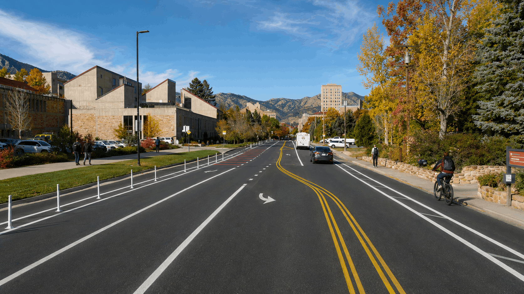
Trail access should also be kept separate from property due diligence. A home near Boulder Creek or another drainage should be checked by exact address against current City of Boulder and FEMA flood information; proximity to a creek does not by itself establish whether a parcel is in a regulated floodplain.
Similarly, properties near Boulder’s western open-space edge may have wildfire-related considerations. The City’s 2024 Wildland Urban Interface Code and local amendments apply to building permits for properties within the WUI area as of August 1, 2025. Buyers contemplating renovation or redevelopment should confirm the current map and code requirements for the exact parcel.
Buyers should independently verify zoning, permits, floodplain status, wildfire mapping, insurance availability and pricing, HOA requirements, property condition, school boundaries, and any other property-specific information with the relevant agencies and qualified professionals.
If trail access is an important part of your Boulder home search, contact Eric for help comparing actual properties, routes, neighborhood access points, and the practical tradeoffs that do not always show up in listing photos. Online trail and property maps are useful screening tools, but they cannot replace reviewing the specific property, disclosures, permit history, insurance quote, HOA documents, contract, or financial situation involved in a purchase.
FROM OUR BLOG
CU Boulder South Is Closing for Years: What the Flood Project Means for South Boulder Residents and Homebuyers
Updated September 29, 2026 CU Boulder South is about to change dramatically. Beginning the week of October 5, 2026, the entire site, including its existing trails, is scheduled to close to public access while the City of Boulder begins the South Boulder Creek Flood Mitigation Project. Construction i
Family-Friendly Things to Do in Boulder: Parks, Trails & More
Boulder is often associated with serious hiking, climbing, and cycling, but experiencing the city with children does not require turning every outing into an endurance event. Some of Boulder's most useful family activities are much simpler: a playground beside a multi-use path, a short walk around a

Pearl Street Mall Guide: Where to Eat, Shop, and People-Watch
Pearl Street Mall is one of the easiest places to start understanding Boulder, but there is an important distinction first-time visitors often miss: the pedestrian mall itself is only four blocks, from 11th Street to 15th Street. Downtown shopping and dining continue east and west well beyond those