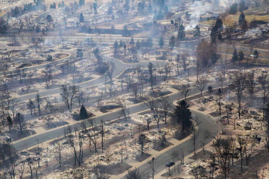
If the Marshall Fire taught Colorado anything, it's that wildfire isn't just a mountain problem. On December 30, 2021, a wind-driven grass fire consumed more than 1,000 homes in Superior and Louisville in a matter of hours — communities that most people would never have described as wildfire country. The Flatirons were visible from the smoke. Boulder residents watched embers fly over their neighborhoods.
That event fundamentally changed how Boulder thinks about fire risk. And in 2026, the city's response has moved from reactive to systematic — a coordinated, multi-front effort that involves cattle, chainsaws, utility companies, federal funding, and neighborhood-level home assessments. For anyone who lives here, owns property here, or is thinking about buying in Boulder, understanding what's being done and why is worth your time.
The Marshall Fire's Long Shadow — and Boulder's Wildfire Landscape
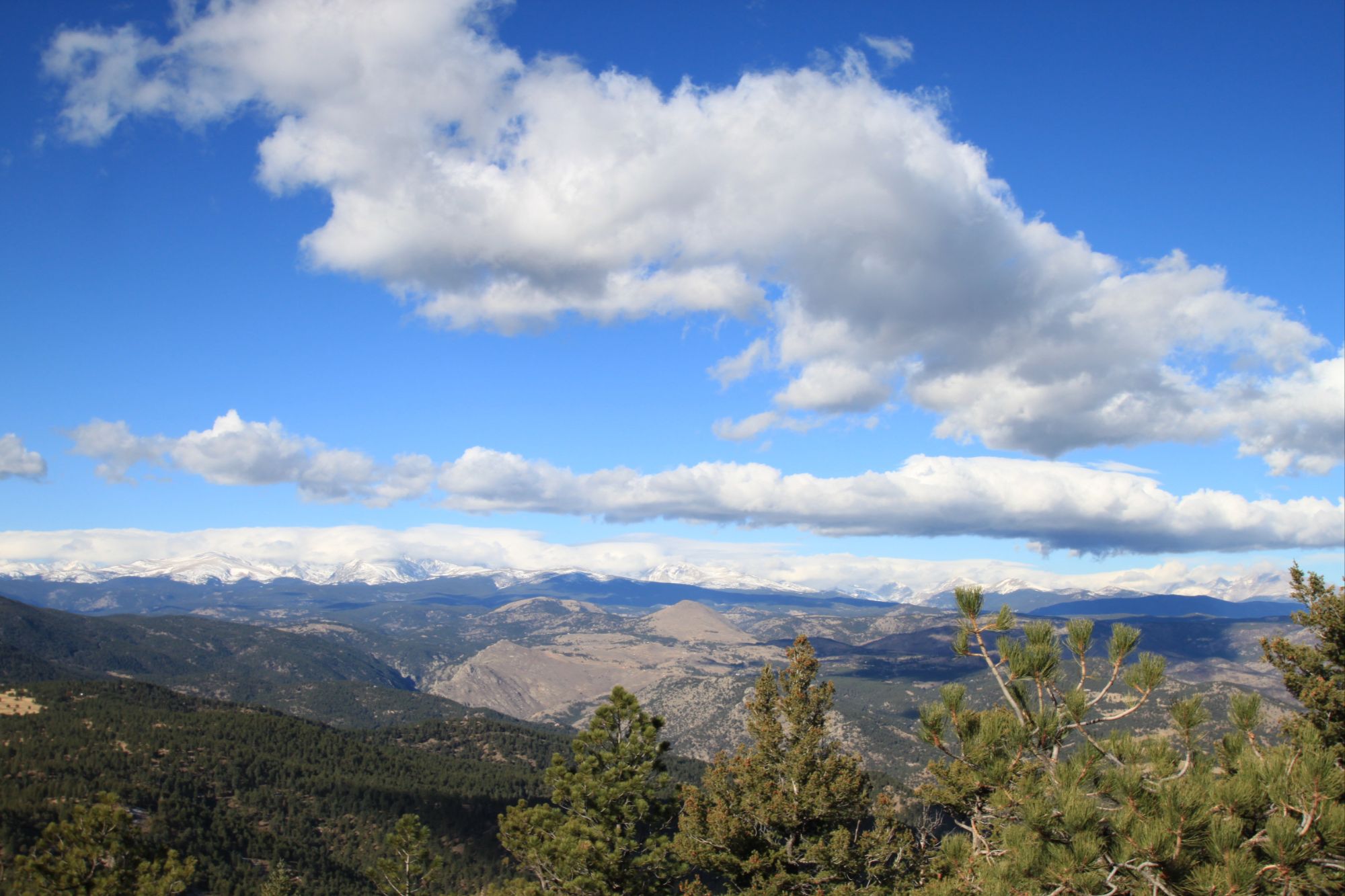
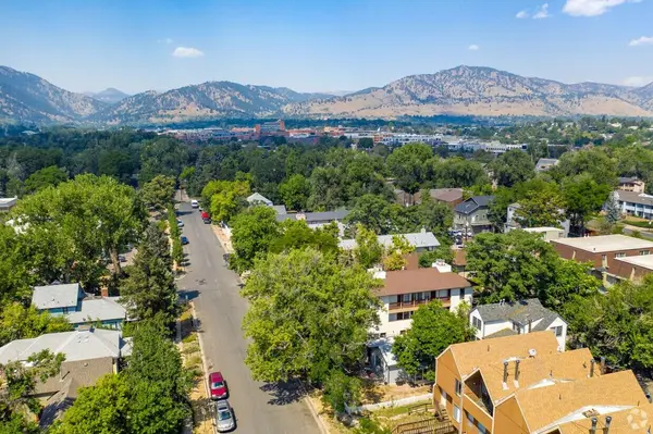
Boulder sits at the edge of one of the most fire-prone landscapes in the country. The wildland-urban interface — where residential neighborhoods meet open space and forest — runs directly through the city's western and southern edges. Chautauqua, Mapleton Hill, Shanahan Ridge, Wonderland Lake, Dakota Ridge, and dozens of other neighborhoods back up against city-managed open space that can carry a fast-moving fire with very little warning.
The risks aren't hypothetical. Before the Marshall Fire, the Fourmile Canyon Fire in 2010 destroyed 169 homes just west of Boulder. The city has a documented history of close calls, and climate trends — longer dry seasons, more frequent high-wind events, warmer winters that limit snow cover — are moving in the wrong direction.
In 2022, Boulder voters approved Ballot Issue 2A, a Climate Tax that allocated dedicated funding through 2040 for wildfire resilience strategies including home risk assessments, mitigation planning, and implementation. In 2024, the city adopted a formal Community Wildfire Protection Plan (CWPP) — a science-based, data-driven document that now guides how the city prioritizes, funds, and implements every project in its wildfire resilience portfolio. What's happening on the ground in 2026 is the product of that planning.
Cattle in the Wildland-Urban Interface: Boulder's Grazing Expansion
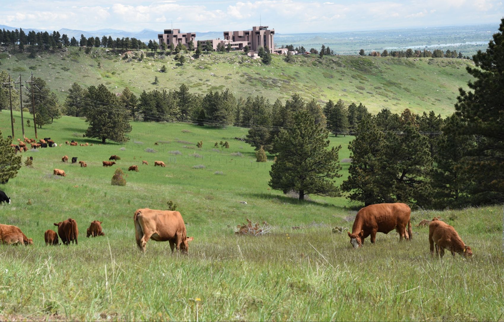
This is the one that surprises people: in June 2026, Boulder brought cows to its open space as part of a wildfire mitigation strategy. Not as a novelty — as a proven, science-based tool for reducing the fine fuels that drive fast-moving grassfires.
The city's targeted cattle grazing program expanded significantly this summer. Cattle are moving progressively north through roughly 65 acres of high-priority wildland-urban interface areas located within 100 to 300 feet of residential neighborhoods — from Alpine Avenue north to Lee Hill Drive, covering areas west of Green Mountain Memorial Park Cemetery, west of Chautauqua, west of 3rd Street, between Mapleton Avenue and Linden Avenue, and around Wonderland Lake. Additional grazing projects are planned for south Boulder in August and September 2026, covering 500 acres of invasive grass management that has been ongoing annually in that area.
The mechanics are straightforward: cattle eat the dry grass and invasive vegetation that accumulates in the wildland-urban interface and acts as fuel for grassfires. After the Marshall Fire, researchers noted that grass-dominated landscapes near neighborhoods were among the most dangerous conditions for rapid fire spread. Grazing reduces that fuel load in a way that is cost-effective, ecologically sound, and doesn't require the noise and disruption of mechanical equipment. The city is partnering with local ranchers selected specifically for their experience using sustainable grazing practices to achieve land management objectives.
Temporary trail closures may occur during grazing operations, and cattle are contained within temporary electric fencing. Residents who walk or bike through these areas will see signs — and, if they look carefully, cows.
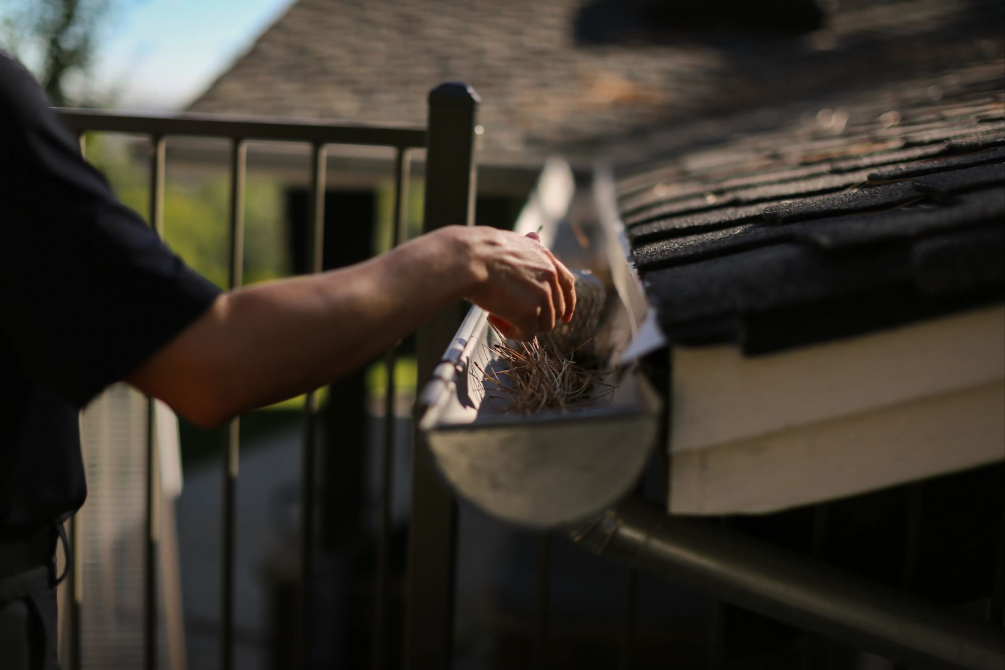
Tree Pruning and Xcel's Utility Work Along Power Lines
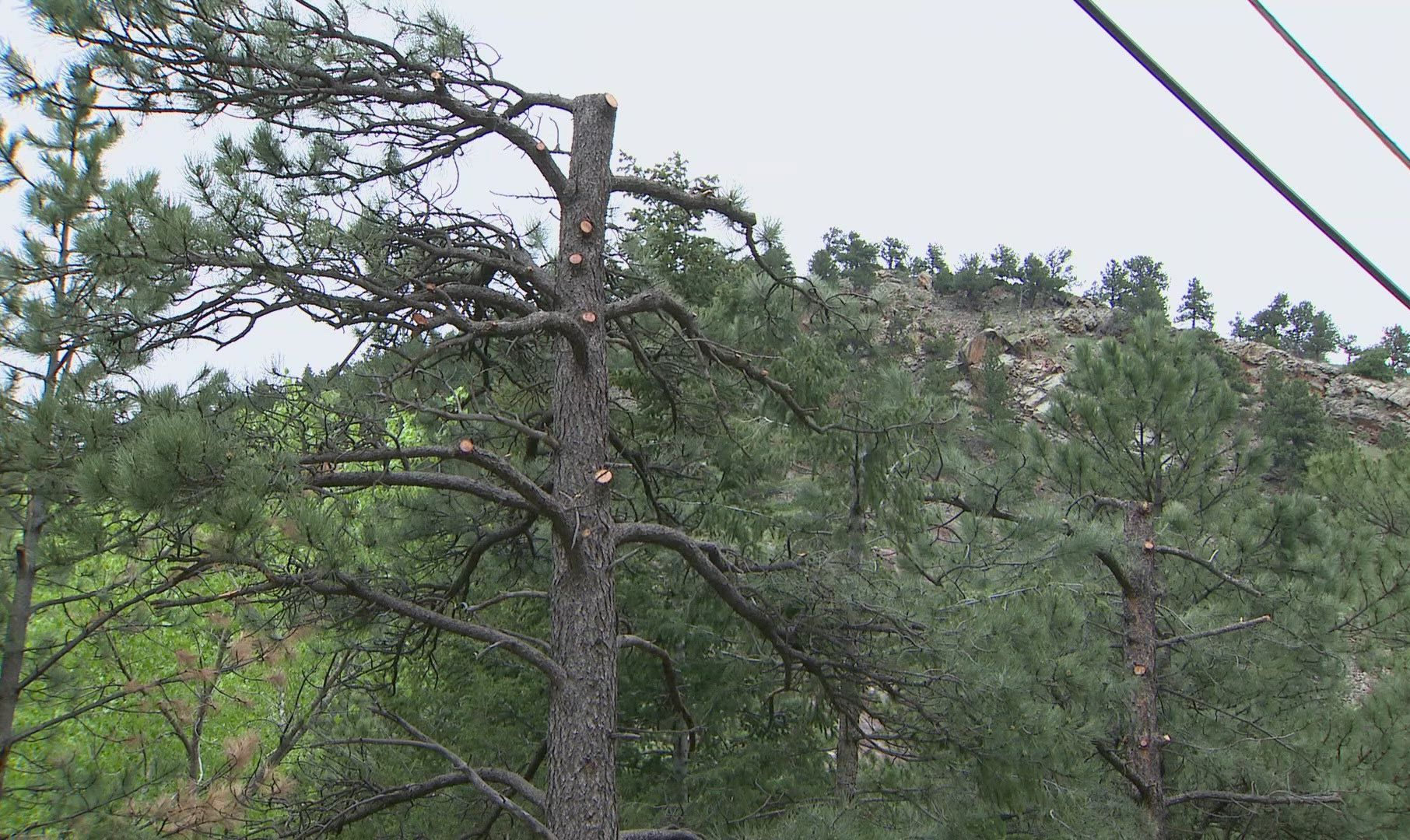
In June 2026, Xcel Energy began wildfire fuel reduction work inside Boulder city limits — specifically targeting trees and vegetation in public street rights-of-way and on private properties where electric lines run. The work is funded entirely by Xcel and is intended to reduce wildfire risk while also improving the reliability and sustainability of the city's electrical infrastructure.
The city's Forestry staff worked closely with Xcel crews to identify which trees would be impacted and how pruning would be approached. The guiding principle: balance wildfire resilience with maintaining a healthy urban tree canopy and natural habitat. No specimen trees are being removed. Only trees in poor condition or poor location — where branches or root systems create meaningful risk near power lines — are targeted for removal. Property owners are being notified directly before crews begin work on private land.
This is part of a broader conversation the city and Xcel are having about longer-term solutions, including the potential for undergrounding power lines in the highest-risk areas. Undergrounding eliminates the ignition risk that aerial utility lines can create during high-wind events — the same type of wind event that drove the Marshall Fire. That work is expensive and takes years. In the meantime, active vegetation management around existing infrastructure is a practical first step.
The fire risk posed by utility lines in high-wind, dry conditions is well-documented. Informed observers note that managing vegetation near power lines is both a safety and property value issue — and one that's increasingly relevant to any conversation about Boulder real estate in the wildland-urban interface.
The Tram Hill Project: Protecting Boulder's Water and Power Supply
In February 2026, Boulder announced a major fuel reduction project on Tram Hill — a city-owned property along a two-mile corridor between Flagstaff Road and Boulder Canyon Drive, west of the city. The Tram Hill project is significant for a reason that goes beyond the open space itself: it protects the infrastructure that keeps Boulder's taps running and the lights on.
The corridor contains critical drinking water, hydroelectric, and electrical infrastructure. A wildfire moving through that area wouldn't just burn trees — it could disrupt water delivery and power generation for the broader community. The project addresses that risk directly by removing trees and reducing fuel loads along the corridor to slow wildfire spread, improve first responder access, and protect what the city has called "vital infrastructure."
The project is funded by a $900,000 grant through the Colorado Strategic Wildfire Action Program (COSWAP), a state-level initiative administered by the Colorado Department of Natural Resources to fund local wildfire risk reduction. The city is collaborating with the Colorado State Forest Service, the Boulder Watershed Collective, and Boulder County on planning and implementation. Wildland firefighters overseen by Boulder Fire-Rescue will burn the resulting log piles in the winter months of late 2026, 2027, and 2028, as weather conditions allow.
The Tram Hill project is a good example of how Boulder is approaching wildfire resilience holistically — not just protecting neighborhoods from fire, but protecting the systems that neighborhoods depend on for daily life.
Neighborhood Protection: Perimeter Mowing, Home Assessments, and WRAP Grants
The most direct connection between Boulder's wildfire resilience work and individual homeowners is a set of programs that operate at the neighborhood and property level — programs that residents in the wildland-urban interface can access right now.
The Perimeter Mowing Program, which began as a pilot in 2024, continues in 2026 with twice-yearly mowing of a 30-foot strip of city-managed open space immediately adjacent to targeted neighborhoods. This year, mowing is focused on Dakota Ridge, Wonderland Lake, Chautauqua, Devil's Thumb/Shanahan Ridge, the Sans Souci Mobile Home Park south of the city, and Lake Valley Estates north of Boulder. Mowing is planned in June/July and again in September/October, with the goal of keeping grass height at four to six inches — reducing the fuel that a wind-driven fire would need to jump from open space into a neighborhood.
The Wildfire Resilience Assistance Program (WRAP) offers direct financial assistance to eligible homeowners in Boulder's wildland-urban interface. Funded by the Climate Tax approved by voters in 2022, WRAP provides up to $2,000 per property for qualifying home-hardening and vegetation management work. The 2026 application cycle is open now, with a deadline of October 1, 2026, or until funds are exhausted. Work must be completed and documented by December 1, 2026.
Boulder Fire-Rescue also offers Detailed Home Assessments (DHAs) — free inspections by Community Risk Reduction Specialists who walk through your property and identify specific improvements that would make your home more fire-resilient. A DHA is required before applying for WRAP funding, and it's a worthwhile exercise regardless of whether you plan to apply.
What This Means for Boulder Real Estate
Wildfire resilience work affects Boulder real estate in ways that are increasingly concrete. Insurance is the most immediate pressure point: properties in the wildland-urban interface have faced growing difficulty obtaining and maintaining coverage in Colorado, a trend that accelerated after the Marshall Fire. Homes in areas where documented mitigation work has been completed — whether by the city on adjacent open space, or by homeowners on their own properties — have a stronger story to tell to insurers and future buyers.
Generally speaking, buyers in the current market are asking questions about wildfire risk that they simply weren't asking five years ago. Proximity to open space is still a premium in Boulder, but it now comes with an expectation that the interface has been actively managed. Neighborhoods like Chautauqua, Shanahan Ridge, and Dakota Ridge — where the city is running perimeter mowing, grazing, and forestry programs — are demonstrating that proactive management and property value are not in conflict.
For sellers in the wildland-urban interface, the city's active investment in these programs is genuinely relevant to how your property is positioned. If your home is adjacent to land where fuel reduction work has occurred — or if you've completed home-hardening improvements through WRAP or on your own — those details belong in your listing conversation.
And for buyers considering homes in Boulder's western and southern neighborhoods, it's worth asking your agent specifically about what wildfire mitigation programs are active near any property you're evaluating. The city's WildfireReady webpage at bouldercolorado.gov/WildfireReady is the most current and complete resource — and it's updated as projects progress.
It's always best to consult with a local real estate professional who understands how wildfire risk, insurance considerations, and city mitigation programs intersect with the specific property you're evaluating. That's a conversation I'm happy to have.
FROM OUR BLOG

The True Monthly Cost of Owning a Home in Boulder
The true monthly cost of owning a home in Boulder is more than the mortgage payment shown by an online calculator. A realistic budget should include principal and interest, property taxes, insurance, utilities, HOA dues, maintenance reserves, and any property-specific expenses related to flood expos
What’s New in Boulder: Summer 2026 Restaurant, Retail and Lifestyle Updates
Editor’s note: Business openings, hours, and development plans can change. The information below was verified as of July 23, 2026. Confirm current details directly with each business before making a special trip. Boulder’s business landscape continues to evolve this summer. New restaurants are bring
Best Boulder Neighborhoods Near Top-Rated Schools: A Buyer’s Guide
A search for the best Boulder neighborhoods near top-rated schools usually involves more than finding the campus with the strongest score. Buyers also need to determine which school is assigned to a specific address, whether that assignment will change, how students would get to school, and what typ